What La Niña could mean for Canada’s upcoming summer

Folks along the East Coast should prepare for a long hurricane season ahead
Ongoing changes in the eastern Pacific Ocean reveal that El Niño is rapidly waning and La Niña is roaring in for the summer.
A sudden flip from one pattern to the other could have big implications for our summertime weather. Not only could we see a very active Atlantic hurricane season, but similar years in the past give us a clue for what we might expect across Canada during the upcoming summer.
DON’T MISS: Experts predict an extremely active 2024 Atlantic hurricane season
A rapid change in the Pacific has far-flung effects
El Niño and La Niña are wonders of our natural world. These small temperature differences in the eastern Pacific Ocean can spark vast changes in weather patterns from Canada to Australia.
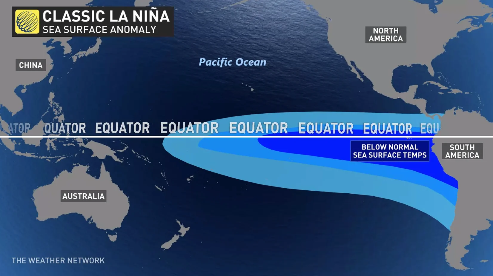
We had a ripping El Niño last year that saw average sea surface temperatures around the equatorial eastern Pacific reach 2.0°C above seasonal. Prevailing easterly winds across the region have increased in recent weeks, though, reversing this trend in a hurry.
Stronger winds push surface waters east away from South America toward Australia. Chilly water from deep within the Pacific rises to the surface in response, forcing water temperatures to dip below seasonal.
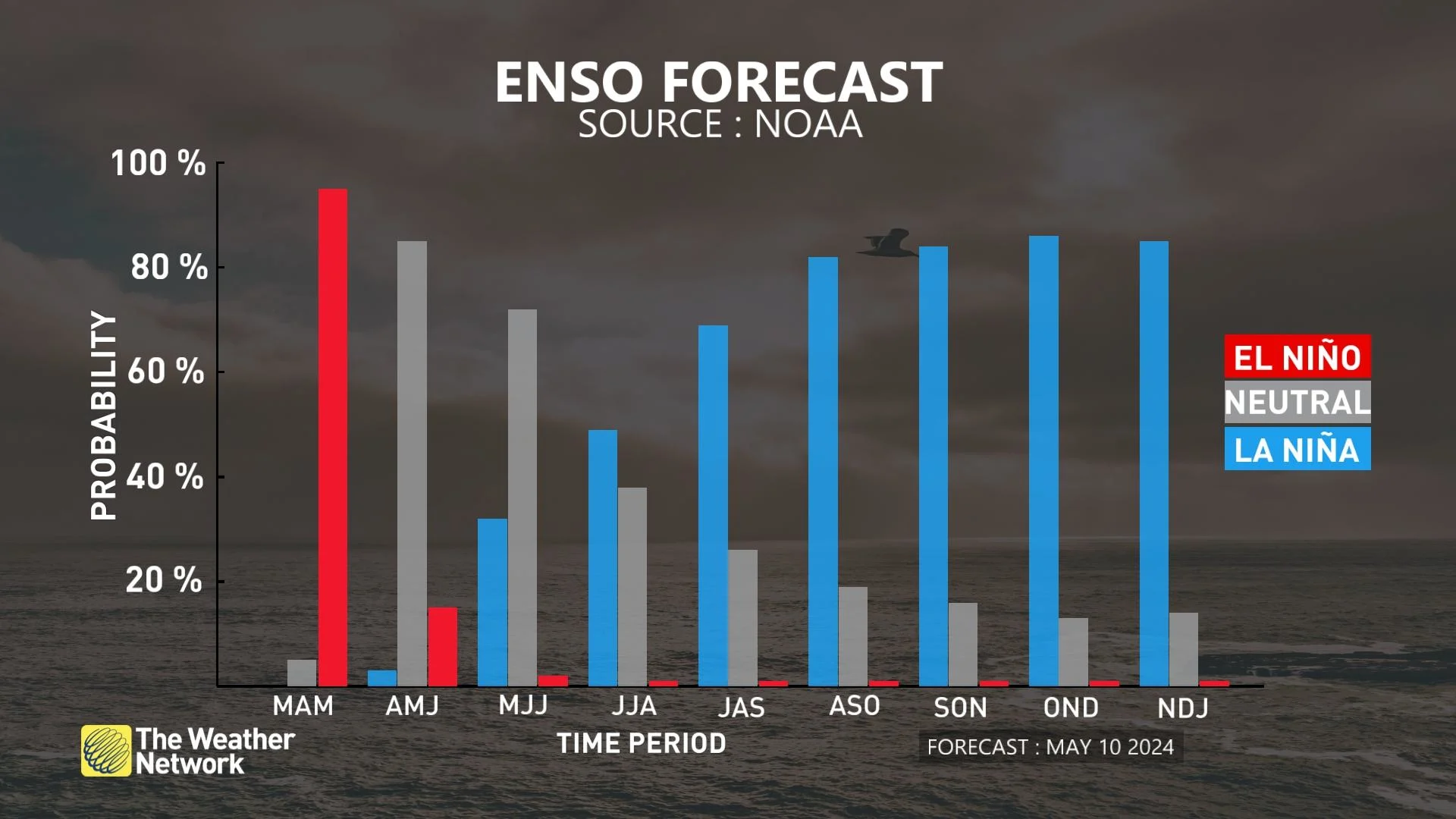
When average temperatures are 0.5°C lower than normal for about half a year, it’s considered an official La Niña event. Given the region’s rapidly cooling water temperatures, forecasters with NOAA have issued a La Niña Watch for the months ahead.
The agency’s latest forecast calls for better-than-even odds of neutral conditions—neither Niño nor Niña—through the remainder of spring, followed by a very good chance that we’ll fall squarely in La Niña territory by the middle of the summer.
Changeable patterns, very active hurricane season
What could that mean for conditions here in Canada? While these patterns are most impactful during the winter months, they can have a noticeable effect on our summertime weather. Lurching directly from an El Niño to a La Niña makes a difference, as well.
The summer of 2016 saw a similar quick flip from one to the other, potentially offering some clues for what to expect in the season ahead.
That season began with above-seasonal temperatures in Western Canada while cooler-than-normal conditions dominated eastern portions of the country. Toward the latter half of the summer, though, things flipped around with warmer conditions back east and generally cooler temperatures in the west.
MUST SEE: How hot water fuels the world’s most powerful hurricanes
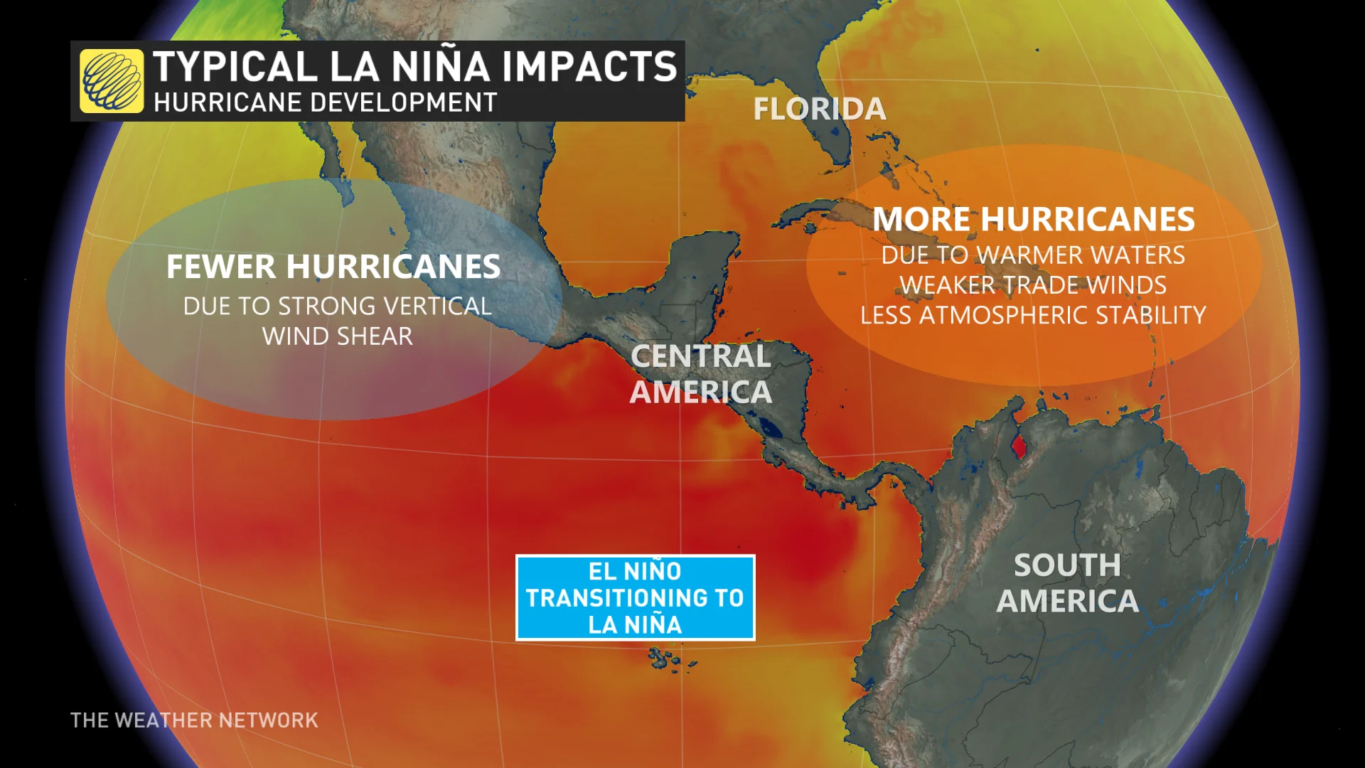
It’s also a big deal for hurricane season. Waters across the tropical Atlantic Ocean are running exceptionally hot right now. Readings back in February hovered around the average sea surface temperature you’d expect to see in July—and they’re still just as hot today.
La Niña decreases the amount of wind shear blowing over the Atlantic Ocean, which is favourable for a more active hurricane season. Lower wind shear increases the opportunities for disturbances to take root and develop into full-fledged storms.
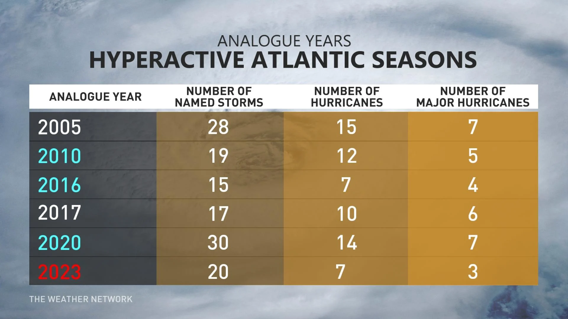
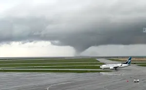
The combination of very warm water and La Niña in full bloom during the late summer and early fall has forecasters worried. Experts across the board expect an extremely active Atlantic hurricane season this year, which could increase the risk for active weather across the East Coast, as well as parts of Ontario and Quebec.
Folks across Atlantic Canada should prepare in advance for an active hurricane season in the months ahead. It’s never too early to put together a preparedness kit or make plans in the event of flooding or potential evacuations.